Phenology-based land cover classification using Landsat 8 time series
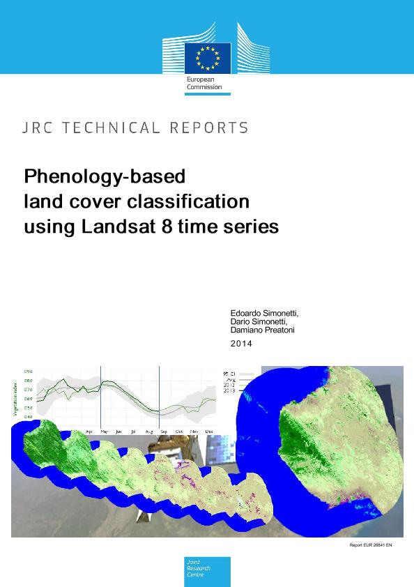
This article describes the methodology and results of a new JRC phenology-based classification algorithm able to generate accurate land cover maps in a fully automatic manner from Landsat 8 (L8) remote sensed data available since 12th April 2013 at no charge throughout the USGS website. A preliminary study aiming to bypass the single date classification inaccuracy (mainly due to seasonality) using long term MODIS time series as a “driver” to fill gaps between high resolution data, has been carried out. The high global acquisition frequency (~16 days) and distribution policy are making Landsat 8 product extremely suitable for near real time land cover mapping and monitoring.
Five national parks in east Africa have been selected as study areas (Mahale Mountains, Mana Pools, West Lunga, Gorongosa, Tsimanampetsotsa); they are covering diverse eco-regions and vegetation types, from evergreen to deciduous. A buffer of 20 km around each park has been considered as well.
Selected single date images were first preprocessed in order to convert raw DN values to top of atmosphere (TOA) reflectance and minimizes spectral differences caused by different acquisition time, sun elevation, sun-earth distance, and after processed by the algorithm to generate a thematic raster map with land cover classes. Is worth noting that the single date classification accuracy is closely related to the acquisition date of the image, the status of the vegetation and weather conditions such as cloud and shadows often present in tropical regions; here the need of developing a phenology based algorithm that considers the vegetation evolution and generates a more accurate land cover map including evergreen and deciduous discrimination on the basis of “frequency” rules.
Land cover maps have been created for all parks and an exhaustive accuracy assessment has been carried out on Mahale Mountains and Tsimanampetsotsa. The combined overall accuracy of 82.8% demonstrates the high potentiality of this method and makes it usable at either local or regional scale.
SIMONETTI Edoardo;
SIMONETTI Dario;
PREATONI Damiano;
2014-10-16
Publications Office of the European Union
JRC91912
978-92-79-40844-1,
1831-9424,
EUR 26841,
OP LB-NA-26841-EN-N,
https://publications.jrc.ec.europa.eu/repository/handle/JRC91912,
10.2788/15561,
Additional supporting files
| File name | Description | File type | |
|---|
